Sunday, August 14, 2011

Sunday Morning at NWR


Nothing fancy, just a mid-August Sunday outing to the Noxubee Wildlife Refuge with some children. In the spirit of Last Child in the Woods: Saving Our Children from Nature Deficit Disorder by Richard Louv, we take the kids out to the wilderness as often as possible so that they might grow up to value natural areas.

The water in Bluff Lake was low, so we were able to walk out among the cypress knees. Saw a bald eagle flying over the lake as we drove in. Not much blooming at the Morgan Hill Overlook, just some mountain mint (white) and partridge pea (yellow in the top picture). They burn that meadow every January, which is too often if you ask me. They should let it grow for three or four years and build up some diversity. In the roadside ditches we saw ironweed and goldenrod. The Callicarpa has berries starting to show some color.

Theodore Roosevelt Island National Memorial

One highlight of our recent trip to the District of Columbia was a visit to the Theodore Roosevelt Island National Memorial. Here is GE shot of the Island in the urban context, with Arlington, VA on the left (west) and the Lincoln Memorial and part of the National Mall recognizable on the right.


Aside from the Memorial Space, the fountains of which had been drained and were under repair, and a trail system, the island appears natural and undeveloped and is a peaceful and shaded contrast to the surrounding cities.


In the above picture our dog is swimming in the channel near the northwestern corner of the island, with the buildings of Arlington rising above the trees of the river buffer. For her, this excursion was a welcome break from the highly recommended downtown dog boarding facility where she spent most of her time.


This image shows a debris jam on the eastern side of the island and a view across the main channel of the Potomac River to the Washington side. Walking around on the island one gets a feeling of being in just about any eastern woodland forest miles from the city. The picture below could have been taken at Duke Forest or Eno State Park in Piedmont North Carolina. We saw a turtle at the southern end of the island in the estuary and two deer in the woods on the ridge in the middle of the island.


The park features extensive woody wetlands containing the non-native yellow flag iris and the indigenous Sagittaria latifolia, or broadleaf arrowhead. A boardwalk traverses much of the wetlands. There are also marshes and an estuary draining the island to the south. Signage indicates that although the system is too far from the Atlantic Ocean for salt water to be of any influence, the level of inundation is affected by tides.


Your humble narrator poses at an estuary observation platform. A three-shot panorama stitched in PhotoShop. You can click on the image to open a larger version, and click again to make it even larger, and look for the seams, but you won't find them.


A four-photo wide shot of the estuary stitched in PhotoShop.


An unusual view of the Lincoln Memorial under the Theodore Roosevelt Memorial Bridge.


An interesting "room" under the Theodore Roosevelt Memorial Bridge.


The route we took mapped in Google Earth. The park was used extensively by joggers throughout the day and into the evening. We were able to park on the Arlington side and walk across a pedestrian bridge (visible in the middle of the western channel in this aerial image) to get onto the island. The residents of Arlington and the district are fortunate to have such a large wilderness area in such proximity in the form of a national park. In Starkville terms, it would be like having the Noxubee Wildlife Refuge as a five minute walk from campus. Such a thing is still possible: South Farm has potential wilderness area and there are various undeveloped or blighted areas all around town. Oh but such thoughts are mere dreams buffeted by the flimsy tubes and html codes of the internet.

Tuesday, June 21, 2011

Landscaping at my brother-in-law's beach cottage


I don't know what you guys like to do on your summer vacation, but I always like to get some landscaping in wherever I go. My wife's brother has a cottage called La Tortuga on Oak Island, North Carolina where our family goes occasionally for a week at a time. Last year many of the cottages on the island were converted from septic systems to the town sewer. This left the driveway in a rough and weedy state. While there last May, my wife, my other brother-in-law and I regraded the drive and spread eight tons of crushed stone.


Digging out wire grass so we can grade.


Job done. If you thought it looked better with the grass there, don't worry. That wire grass is coming right back. But now there is a smoother, more stable surface for parking and unloading. I planted a pittosporum and a few knophofia and homestead purple verbena near the electrical boxes.


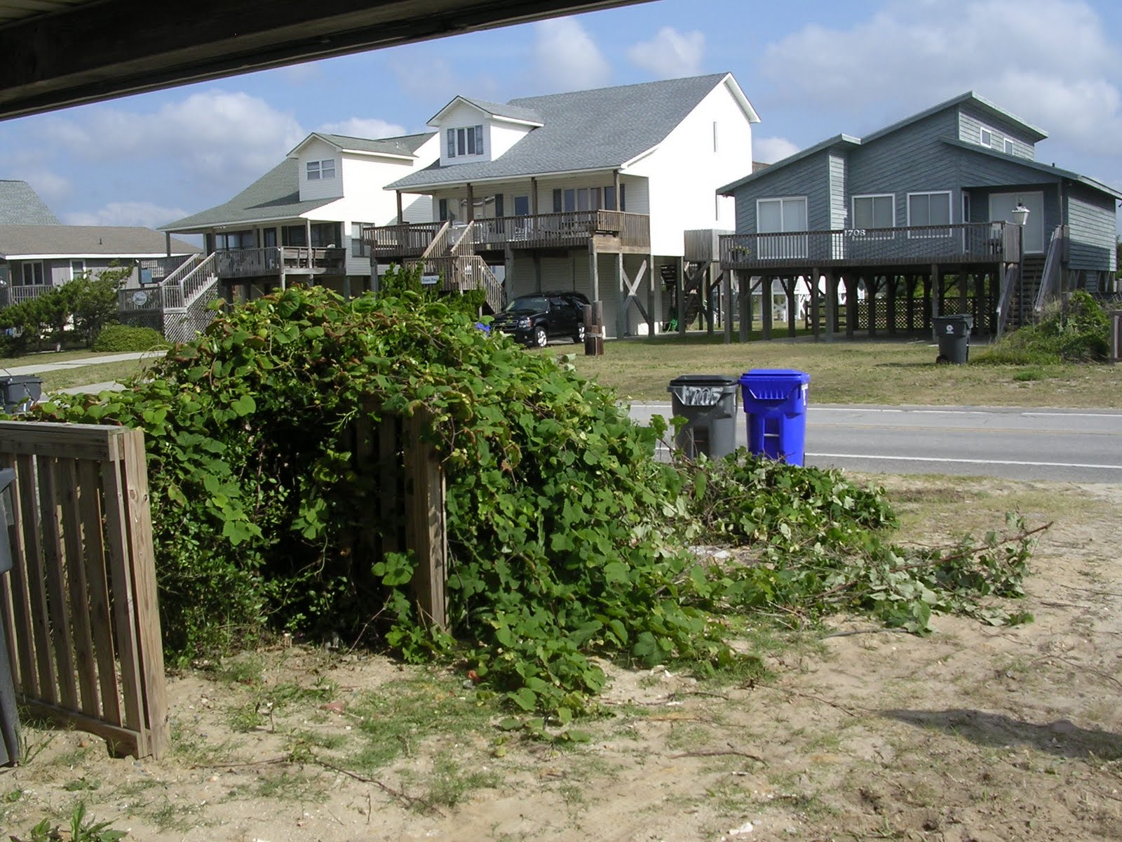
Kudzu on the trash container corral.


Kudzu gone! The existing compacta hollies were pretty beat up from the sewer installation operation. We hope they can recover now that the kudzu is removed.

I encourage everyone to go out to the Carolina Coast and rent my brother-in-law's beach cottage, La Tortuga! A classic three-bedroom cottage with knotty pine paneling, a wonderful place to relax.

Wednesday, June 15, 2011

Taughannock Falls

Last month my wife and I took the kids to Ithaca, NY to visit my mother. My sister came up from Charlottesville. We visited Taughannock State Park. We hiked the Gorge Trail, three-quarters of a mile one way up Taughannock Creek to Taughannock Falls. My mother claimed that there were rim trails, but that they had been closed because the rim tends to collapse and it can be dangerous. Abundant signage warns folks to stay on the trail to avoid being harmed by unpredictable avalanches. The talus slopes (can’t resist the chance to use a word from geomorphology) of both sides of the canyon showed ample evidence of recent cliff failures. There are also plenty of areas where the talus, or debris field, was covered over with mature forest. Somebody claimed that Taughannock Falls is the tallest waterfall east of the Mississippi. When I looked it up online, I found that there are several places that make such a claim, and an interesting debate on exactly how you measure the height of a waterfall. Taughannock Falls is listed at 215 feet, and it appears that most of it is unobstructed. Of those making the claim, I am most impressed with Fall Creek Falls in Tennessee.


Trail map carved out of SOLID WOOD.


This is the first cascade on the trail. Educational signage explains that this is a limestone slab supported by shale. The shale is erodible and the limestone comparatively resistant. The shale erodes constantly, and, when enough of it is washed away, the limestone breaks off in larger pieces. Toughannock falls was located at the park entrance near Cayuga lake at the end of the last ice age. Since then the falls have retreated 3/4 of a mile due to this erosional process.


Cliff face, mostly shale, with some sandstone strata. Interesting how it comes off in rectilinear patterns. A simple description of the local formation layers can be found here. This creek flows into Cayuga lake, which is 435 feet deep. The actual depth to the carved rock is much deeper. The lake bed contains up to a thousand feet of glacial sediment in some places.


Two-photo panorama of a recently-augmented talus slope and cliff face with little boy for scale. After I took it I said, "OK now let's get down from there."


Most of the trail looks like this. As the signs indicate, the park personnel would really honestly prefer that you stay on the trail.


First view of the falls from the trail. This is another two-photo panorama stitched in PhotoShop. It was taken from a bridge that crosses the channel. Check out the huge talus slope on the right, the relatively small people, and the observation deck. Also the pattern of cliff erosion looks like temple carvings from other worlds.


Another view of the cascade.


Zoom in on the cliff face. I believe the white streaks are granite layers.


Rocks of various sizes and shapes in the channel


Children skipping rocks by the creek. Plenty of rocks to choose from. Trees, shrubs and grasses grow in the debris of past avalanches.


From the observation area, looking back at the bridge that takes the trail across the creek.

Saturday, April 9, 2011

Cool Map

I love maps. Check out these. Artist and programmer R. Luke Dubois used information from millions of online dating sites to create county-level maps of the United States based on words most often used in profiles. In an interesting twist on the red state/blue state dichotomy, Dubois uses the colors to represent men and women, and the brightness of the color represents the frequency of the word. North Texas and the state of Wyoming has a lot of lonely men, while the lonely women can be found in the South Carolina low country. Also interesting is the brightness flip between the "crazy" and "shy" maps. The northern plains are shy, while the coastal areas are crazy.
Dubios has another set of maps where he places the words themselves onto the map surface according to the spatial location at which they occur in the dating profiles. These are really interesting at the regional level: artistically geo-referenced local vernacular expression. "Gaslight," "Codder," and "Drinks" appear in the Boston suburbs. "Fastball," "Jailer," and "Irrigation" show up in Eastern Nebraska.

Saturday, March 19, 2011

Private Satellite Images Used to Investigate War Crimes

Something on the PBS Newshour last Thursday caught my attention. A private company, Digital Globe, has obtained satellite images that document the destruction of a village in an area of Sudan where no journalists are allowed. The images were made public online by the Satellite Sentinel Project. The celebrity George Clooney actively supports both the Satellite Sentinel and Digital Globe. The story points out that commercial satellite imaging entities can make information available that until recently was the sole province of governments. Unfortunately it does not explore the ethical implications. They imply that digital globe is just giving the information away for the good of humanity. Commercial (and government) satellite images are very expensive to produce, and a discussion of what the Satellite Sentinel Project paid for the images, or what Digital Globe typically charges their clients, would have been interesting. The piece could have brought up the issues of personal privacy (there seems to be no place on the globe now that is not being photographed), and the privileged status of the information: who is obtaining it and for whom? But maybe I ask too much. The report was particularly interesting to me because I am taking a remote-sensing class, wherein we are learning how to interpret satellite data, and a class in ethics and philosophy in geography, where we recently discussed celebrity activists.

Saturday, March 5, 2011

My Google Earth Street View Experiment

I was very impressed with Jon Rafman's collection of Google Earth street view image captures (here). My first response was "Oh man I have got to try that." Up late for two nights, the house is a wreck and I am way behind on school work. But this project has a geographical and artistic component, so I justify (rationalize?) it as being part of my status as a lifetime learner. But really I am just a Google Street View addict trying to one-up an established artist.

By no means do I think my images are as riveting and interesting as Rafman's. In two days since I started I have explored Tallahassee, the Florida Panhandle, the Atchafalaya River corridor in southern Louisiana, Stuttgart, San Luis Potosi Mexico, Northwestern Canada and Lisbon. I get a kind of rush when exploring, looking at all the cameras on the screen lined up like beads: so much to find! So many unexplored niches, so many places no one has ever seen...world here I come!

I do in fact believe that most of Street View is unseen. The images are fed into the system and processed in batches. Among the viewers, there are probably very few like Rafman and myself, that is, trolling for images to capture and re-present as art.

What is the point? I try to stay away from slum-tourism. Rafman presents a lot of prostitutes and people with guns. I am collecting my images with the knowledge that Rafman has already done it. I am trying to capture something a little different, but really just trolling for anything that can be viewed as an interesting composition. And if I happen upon somebody with a gun, it is definitely going in the collection.

Rafman has some interesting commentary on his website, I encourage you to poke around over there.

And without further ado, here is my two days worth of Google Street View (click inside any image for a larger format version):


A house for a car. Humans enter in rear.


Yin and yang.


Notice parrot in cage on counter.


Man with camera looking directly at camera. In Stuttgart, the GE camera person takes the unit off the car and walks around. And they don't blur faces.